


It’s December and it’s getting properly cold outside. With winter on the horizon, birds across the continent are moving south and on these cold late-fall mornings I sometimes wish I could do the same.
The lack of an abundant food source is what, for most, demands a move south. And for some species, this means flying as far as Central and South America.
It’s always amazed me how birds find their way during these annual migrations. Some scientists believe migratory birds take their navigational cues from the sun, moon and stars. Others think they simply follow geographic landmarks like rivers and mountains. Nobody knows for sure and maybe never will.
What we do know is that migratory birds consistently follow the same flight paths, converging every year on “flyways.” Think of them like nature’s interstate system.
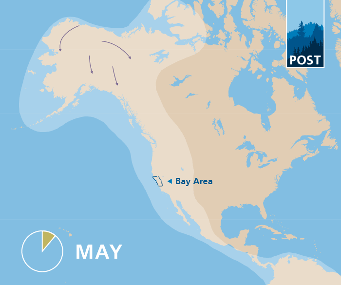
There are four flyways that span across North America–the Pacific, Central, Mississippi and Atlantic Flyways (don’t worry, there won’t be a quiz on any of this).
California lies within the Pacific Flyway, an area that stretches from the Arctic to the coast of Mexico, and from the Rocky Mountains to the Pacific. North to south it’s over 4,000 miles long and, in places, over 1,000 miles wide.
The San Francisco Bay is a critically important stopover for birds moving along the Pacific Flyway. As the largest estuary (tidal mouth of a large river) on the Pacific coasts of both North and South America, the Bay offers an abundance of habitat for tired migrant birds. And it’s not just wetlands that make the Bay Area so attractive. There’s a diversity of habitat types here offering refuge for birds of all kinds – it’s an avian paradise.
The importance of Bay Area open spaces to the Pacific Flyway is clearest when considering the concentration of the region’s Important Bird Areas (IBAs). Yea, what’s an IBA? The National Audubon Society is leading an effort to identify, monitor and protect the planet’s most important places for birds. These areas are determined using internationally agreed criteria and are called, quite simply, “Important Bird Areas.”
The interactive map below illustrates our region’s IBAs and the overlap between these areas and the land we’ve helped protect. Explore more below and learn about one of the Pacific Flyways’ greatest stopovers:

Want to learn more about birds in the Bay Area? Download our Natural Guide to Bay Area Birds—an illustrated guide to the most iconic birds in our open spaces!
Click here to download!
More on Our Website


About Post
Peninsula Open Space Trust (POST) protects open space on the Peninsula and in the South Bay for the benefit of all. Since its founding in 1977, POST has been responsible for saving more than 87,000 acres as permanently protected land in San Mateo, Santa Clara and Santa Cruz counties. Learn more