


On a recent overcast morning, a friend invited me to go on a rainy day walk. A lifelong San Josean (minus a detour or two!), I am unaccustomed to chilly, damp weather. Still, I emboldened myself, slipping into my disused raincoat and waterproof boots. I practiced some impromptu mindfulness and surrendered to the fact that we were going to get exposed to the elements. While our hair did get much frizzier, we managed to stay mostly dry. We had a fantastic (and rejuvenating!) time.
Even on the weekend, the paved trail, we found, was almost vacant. The brisk air — scientifically proven to be cleaner — smelled crisper than usual. Turns out we were getting our fix of petrichor (the technical name for the aroma that results from rainfall on dry soil). Rather than being a drag, the drizzle incited some whimsy. We found ourselves stamping through puddles with abandon.
Check for Trail Closures!
Unless you’re an experienced hiker with the requisite gear, navigating muddy trails can be daunting and dangerous. What’s more, in the aftermath of recent storms, trail closures have become more common. In addition to being sturdier, paved trails are often closer to home. A serious bonus: you don’t have to drive on treacherous windy routes to find nature. Still, owing to potential flooding and other hazards, it’s crucial to visit official websites to check out the trail conditions before you head out.
Paved Trails for Rainy Day Walks
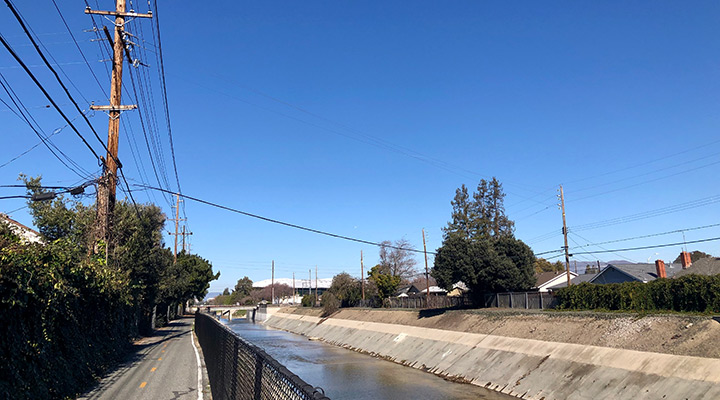
San Tomas Aquino/Saratoga Creek Trail
This 4.6-mile asphalt trail follows the creek corridor through the city of Santa Clara. From its Monroe Street entrance, it extends to the Guadalupe Slough on the southern end of the San Francisco Bay. When the creek is flowing, the sound of rushing water adds a soothing ambiance. Listen, too, for the call of the Pacific chorus frog in the spring. With so many mallards, egrets and black phoebes, it’s also an A+ birding spot. Due to its suburban locale, you’ll pass under road crossings and spy glimpses of tech campuses and Levi’s Stadium. Feel free to bring your pup along on a leash!
For information on closures of the trail for maintenance or weather, visit the City of Santa Clara’s website.
Coyote Creek Trail
The main southern segment of this mostly flat, scenic route runs along (you guessed it!) Coyote Creek. It extends through South San Jose and Coyote Valley, ending near Anderson Lake County Park in Morgan Hill. A good starting point is Hellyer County Park, which features parking, restrooms and multiple resting areas. The trail’s namesake winds through the park’s center, fringed by Oak, Cottonwood and Sycamore trees. This route is dog friendly and accessible for a variety of fitness levels.
For information on closures of the trail for maintenance or weather, visit the Santa Clara County Parks website.
Arana Gulch
This 67-acre open space is located at the eastern border of the City of Santa Cruz. While there’s no on-site parking, street parking is available on Agnes Street. The area features paved multi-use trails as well as a pedestrian loop with interpretive displays. The trails are beautiful but exposed, so be sure and bring your umbrella. Dogs are welcome on a leash. One of the few sites in the County featuring the endangered Santa Cruz tarplant, restoration efforts are underway.
For information on closures of the trail for maintenance or weather, visit the City of Santa Cruz website.
Stevens Creek Trail
Heading southward from Shoreline Park, this 4.2-mile trail runs through tidal marshlands, salt ponds and natural riparian habitats. It can be done as an out and back, or you can connect with the San Francisco Bay Trail and keep going! You can find parking at its primary entrance, at its junction with the San Francisco Bay Trail. Over 40,000 people live within walking distance to this trail, which travels through many neighborhoods, business centers and school grounds.
For information on closures of the trail for maintenance or weather, visit the City of Mountain View website.

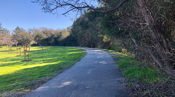
Rancho Cañada del Oro: Llagas Creek Loop
In the foothills of the Santa Cruz Mountains in Santa Clara County is the beautiful Rancho Cañada del Oro Open Space Preserve. There are 12 miles of trails that offer both easy and more difficult options. The half-mile Llagas Creek Loop is great if you’re looking for a short paved trail that is mostly flat. It’s perfect for strollers and wheelchairs. In contrast with the regional trails above, this location has a more remote vibe. The Llagas Creek Loop starts just off the parking area next to Casa Loma Road.
For information on closures of the trail for maintenance or weather, check the Santa Clara Valley Open Space Authority website.
More Stories
About Post
Peninsula Open Space Trust (POST) protects open space on the Peninsula and in the South Bay for the benefit of all. Since its founding in 1977, POST has been responsible for saving more than 87,000 acres as permanently protected land in San Mateo, Santa Clara and Santa Cruz counties. Learn more