


Did you know that one of the largest wetlands in the Bay Area was near San Jose?
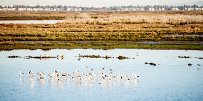
Just south of downtown San Jose, at the intersection of Santa Teresa and Bailey Avenues, lies the Laguna Seca – historically a 1,000+ acre freshwater wetland. Despite being dredged, drained and converted to agriculture, parts of the Laguna Seca still exist today and are critically important for wildlife like migratory birds on the Pacific Flyway.
Knowing what this land used to look like helps give us a sense of what was and, through our work, what could be in the future. Take a look at the map of San Jose’s Coyote Valley and the Laguna Seca below. Hand-drawn in 1847 by Chester Smith Lyman, a land surveyor who documented much of California, this map depicts the dominant features of what was then Rancho de la Laguna Seca and offers a glimpse of how water once flowed over the valley floor.
While not shown on this map, we know from research conducted by our partners at the San Francisco Estuary Institute and the Santa Clara Valley Open Space Authority that most of the water on the western side of Coyote Valley never moved through a defined channel or creek. Instead, the water slowed and fanned out across the landscape, creating a mosaic of wet meadows and ponds, providing habitat for a variety of wildlife and percolating into a groundwater basin that now supplies San Jose with drinking water.
But things have changed in Coyote Valley since Lyman drew his map. Just over 100 years ago, in early 1916, the Laguna Seca Reclamation District was formed to “reclaim” about 1,200 acres of wetlands and wet meadows, which were drained and subsequently burned to make room for a new booming industry in the Valley – agriculture.
To accomplish this, farmers installed a four-mile-long drainage canal that we now call Fisher Creek. The water that once created habitat and recharged the aquifer in Coyote Valley was instead directed out of the Valley and fed into Coyote Creek – exacerbating the flood risk for downstream locations in San Jose.


Mother nature is resilient though, and over time, Coyote Valley’s flora and fauna adjusted to the new way water moved across the land. Today, Fisher Creek and the surrounding vegetation provide important habitat for wildlife in Coyote Valley. In fact, the creek has become an essential pathway for wildlife movement in the Valley.
These lessons from the past are significant as we embark on our campaign to protect land and create ecological uplift in the Coyote Valley. This work isn’t about trying to recreate the past, but it is important to learn from the land’s history. By combining our understanding of the land’s historical ecology with the scientific tools of today, we hope to build a bright future for this once amazingly rich wetland ecosystem.
Mapa del Rancho de la Laguna Seca : de la propriedad [sic] de Dn. Guillermo Fisher [Santa Clara Co., Calif.] / C.S. Lyman, Surveyor courtesy of the Bancroft Library, University of California, Berkeley
SCVWD Vault, 1916. [Photographs of Rancho Laguna Seca – SCVWD]. Courtesy of Santa Clara Valley Water District. San Jose, CA.
More on Our Website


About Post
Peninsula Open Space Trust (POST) protects open space on the Peninsula and in the South Bay for the benefit of all. Since its founding in 1977, POST has been responsible for saving more than 87,000 acres as permanently protected land in San Mateo, Santa Clara and Santa Cruz counties. Learn more